
Orthophotography
Producing orthophotography is one of Aeroquest Mapcon's core competencies. Whether the project is several frames, or several thousand frames, we have the production processes in place to deliver high quality, accurate, and colour balanced imagery. Our highly experienced staff, top level software & hardware, efficient workflow and attention to detail means that our clients receive the highest quality orthophotography available.
Colour Orthophotography
Natural colour orthophotography offers our clients 3-band (Red, Green, Blue) rectified imagery that has been colour corrected, radiometrically balanced and seamlessly mosaicked. This type of product allows for viewing ground detail in natural color to assist in feature identification (vegetation, utilities, surface/terrain types, etc) and can be produced in a wide range of pixel sizes depending on the project requirements and source imagery (satellite, aircraft, UAV).

Near-INFRARED ORTHOPHOTOS
Near-infrared imagery can often be captured from aerial cameras and satellite sensors simultaneously with natural colour imagery, and is delivered to the client as a 4-band image (R,G,B,NiR). Near-infrared imagery allows for different types of image classification applications such as storm water management, environmental studies, moisture analysis, impermeable surface analysis, planning and engineering design.

MultiSpectral Imagery
For specific applications, multispectral imagery captured from satellite sensors can provide our clients with spectral data specifically tailored to their needs. Some of available spectral bands include
Panchromatic band
4 standard VNIR colours: blue, green, red, near-IR1
4 added VNIR colours: coastal, yellow, red edge, and near-IR2
8 SWIR bands: Penetrates haze, fog, smog, dust, and smoke
12 CAVIS bands: Maps clouds, ice and snow, corrects for aerosol and water vapour
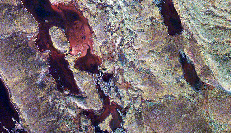
8-band satellite, water depth composite image utilizing the enhanced blue band