
Forestry Mapping
Aeroquest Mapcon has been performing aerial mapping programs for the forestry industry for more than 25 years. These projects often cover large areas in remote wilderness locations and depending on the needs of the client, may include aerial photography, LiDAR, and surveyed ground control. Clients include both government and private industry, with projects ranging from the Pacific Northwest to the far north, and also including the eastern maritime areas.
Project Examples
Provincial Forestry Project
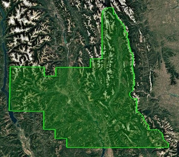
Area: 16,553km² located with the Rocky Mountains.
Acquisition: 25cm aerial photography and 10 surveyed ground control points.
Deliverables: hydro-flattened and colorized high density surface model, a manually collected DTM to model under the tree canopy, a 10m gridded DEM, and seamless 0.5m and 0.3m 3-band RGB and 0.3m CIR orthophotography in UTM and Albers projections.
Northern Canada LiDAR Forestry Program
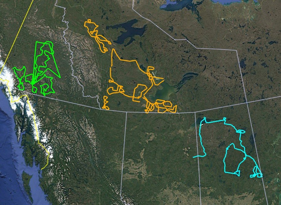
Areas: Yukon: 4,447 linear km, Northwest Territories: 6,364 linear km, Saskatchewan: 3,016 linear km.
Acquisition: 12ppm² LiDAR transects with a swath width of 1,358m flown during summer leaf-on conditions.
Deliverables: Aeroquest Mapcon was contracted to provide classified LiDAR for 13,827 linear km across northern Canada for forestry purposes. The classifications included: 1-Processed but unclassified, 2-Ground, 3-Low vegetation (0.5m - <2.0m), 4-Medium vegetation (2.0m - <5m), 5-High vegetation (≥5m), 7-Low points (noise) (0m to <5m), 9-Water (>10,000m² water body, >30m river width), 18-High points (noise).
Coastal Forestry Program
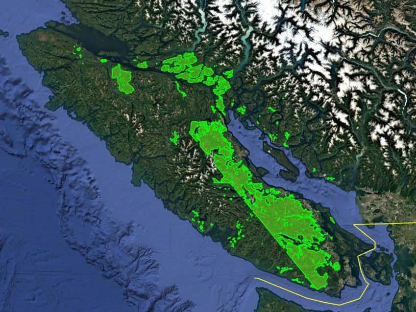
Area: The project area covered parts of Vancouver Island and extended north along the coastline covering a total area of 7,200km².
Acquisition: 20cm aerial photography with 80/30 overlap and 12ppm² LiDAR.
Deliverables: 20cm, 4-band (RGBI) orthophotography, LiDAR classified to ground and non-ground.